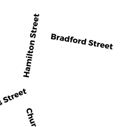
7 BRADFORD STREET
Owner Information
PINTO BRIAN A
25 NYLAN ROAD
BROCKTON, MA 02301


Property Details
7 BRADFORD STREET is classified as a Three-Family Residential (Three family).
The primary structure on this property was built in 1918. There are 5709ft2 of built area within this property. There is 3254ft2 of residential/living space within this property. This property is listed as having 16 rooms.
7 BRADFORD STREET is valued at 367400. The land is valued at 77200 and the structures are valued at 290200.
This property is in Zone 3.33. Confirm with local Zoning Board authorities to ensure there are no overlays or other easements on this property.
The most recent deed for 7 BRADFORD STREET is recorded at the local registrar in Book 6275, Page 0293. 7 BRADFORD STREET was last sold on 1995-10-02 for 0.
Assessment data from fiscal year 2021.
Flood Data
According to the FEMA National Flood Hazard Layer, this property does not appear to be in a flood zone. It may also be in an area not yet reviewed. Nonetheless, confirm this information prior to taking any action.
To view the flood hazards around this property, create a FEMA "Firmette" Map of the area around 7 BRADFORD STREET.
Broadband Internet Providers
| Provider | Type | Bandwidth (mbps) | |
|---|---|---|---|
| HughesNet | Satellite | 25 | 3 |
| Comcast | Cable | 1000 | 35 |
| Viasat Inc | Satellite | 100 | 3 |
| Verizon New England Inc. | Fiber | 940 | 880 |
| GCI Communication Corp. | Satellite | 0 | 0 |
| Verizon New England Inc. | DSL | 10 | 1 |
| VSAT Systems, LLC. | Satellite | 2 | 1 |
Broadband service provider data from December 2020.
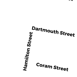
Adjacent Properties
- 5 BRADFORD STREET
Two-Family Residential owned by RODERGUES MARCELINO C & ARLET - 11 BRADFORD STREET
APT 4-8 UT M94 owned by CORNELL BRUCE A & BRIAN C - 16 CORAM STREET
Three-Family Residential owned by REBELO GABRIELLA R - 10 CORAM STREET
Two-Family Residential owned by SILVA ARISTIDES & PAULINA - 8 CORAM STREET
Two-Family Residential owned by TURNER SETH K